Camping Armanello · Benidorm
Distances from Camping Armanello
How long it takes on foot, by bike or by car from the campsite entrance to the beaches, the centre of Benidorm, the theme parks and the most useful services.
Closest to the campsite
A few of the most popular destinations. Below you will find the full list with search and filters.
On foot: 27 min · By bike: 10 min
On foot: 32 min · By bike: 14 min · By car: 7 min
On foot: 28 min · By bike: 10 min · By car: 7 min
On foot: 30 min · By bike: 11 min · By car: 8 min
On foot: 22 min · By bike: 11 min · By car: 6 min
On foot: 15 min · By bike: 5 min · By car: 4 min
Find your destination
Category
42 destinations
Destinations map
All destinations on a Google map, grouped by category. Select a point to see its travel times; for the exact route use “Directions” in the list.
Beaches
Levante Beach
- On foot27 min · 2.0 kmDirections
- By bike10 min · 2.2 kmDirections
- By carZBEDepends on the car park you choose
Poniente Beach
- On foot55 min · 4.1 kmDirections
- By bike24 min · 5.0 kmDirections
- By carZBEDepends on the car park you choose
Cala del Mal Pas
- On foot38 min · 2.9 kmDirections
- By bike15 min · 3.5 kmDirections
- By carZBEDepends on the car park you choose
Cala Almadrava
- On foot39 min · 2.9 kmDirections
- By bike14 min · 3.1 kmDirections
- By carZBEDepends on the car park you choose
Cala del Tío Ximo
- On foot45 min · 3.4 kmDirections
- By bike16 min · 3.8 kmDirections
- By carZBEDepends on the car park you choose
Sightseeing
Old town
- On foot32 min · 2.4 kmDirections
- By bike14 min · 2.6 kmDirections
- By carZBE7 min · 3.3 kmDirections
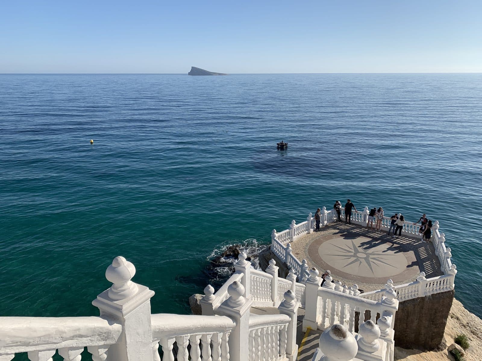
Balcón del Mediterráneo
- On foot38 min · 2.8 kmDirections
- By bike17 min · 3.0 kmDirections
- By carZBEPending verification
Plaza Triangular
- On foot28 min · 2.1 kmDirections
- By bike11 min · 2.2 kmDirections
- By carZBE6 min · 2.5 kmDirections
Parque de l'Aigüera
- On foot36 min · 2.7 kmDirections
- By bike12 min · 2.5 kmDirections
- By carZBE5 min · 2.3 kmDirections
Town hall
- On foot31 min · 2.3 kmDirections
- By bike13 min · 2.3 kmDirections
- By carZBE5 min · 2.4 kmDirections
Benidorm harbour
- On foot37 min · 2.8 kmDirections
- By bike15 min · 3.4 kmDirections
- By carZBE9 min · 3.5 kmDirections
Parque de Elche
- On foot37 min · 2.7 kmDirections
- By bike15 min · 3.4 kmDirections
- By carZBE8 min · 3.3 kmDirections
Cruz de Benidorm
- On foot56 min · 4.2 kmDirections
- By bike20 min · 4.2 kmDirections
- By carZBE18 min · 4.2 kmDirections
Serra Gelada
- On foot78 min · 5.8 kmDirections
- By bike21 min · 6.5 kmDirections
- By carZBE10 min · 6.2 kmDirections
L'Albir lighthouse
- On foot110 min · 8.2 kmDirections
- By bike31 min · 9.0 kmDirections
- By carZBEPending verification
Tecnohito
- On foot28 min · 2.1 kmDirections
- By bike11 min · 2.2 kmDirections
- By carZBE6 min · 2.5 kmDirections
Leisure
Aqualandia
- On foot28 min · 2.1 kmDirections
- By bike10 min · 2.3 kmDirections
- By carZBE7 min · 2.1 kmDirections
Mundomar
- On foot30 min · 2.3 kmDirections
- By bike11 min · 2.4 kmDirections
- By carZBE8 min · 2.2 kmDirections
Terra Mítica
- On foot101 min · 7.9 kmDirections
- By bike34 min · 7.7 kmDirections
- By carZBE13 min · 7.8 kmDirections
Terra Natura
- On foot70 min · 5.3 kmDirections
- By bike24 min · 5.5 kmDirections
- By carZBE12 min · 5.8 kmDirections
Aqua Natura
- On foot77 min · 5.8 kmDirections
- By bike28 min · 6.0 kmDirections
- By carZBE15 min · 6.4 kmDirections
Benidorm Palace
- On foot19 min · 1.4 kmDirections
- By bike5 min · 1.4 kmDirections
- By carZBE5 min · 1.4 kmDirections
Festilandia
- On foot27 min · 2.0 kmDirections
- By bike10 min · 2.1 kmDirections
- By carZBE6 min · 2.3 kmDirections
Cableski de Benidorm
- On footPending verification
- By bikePending verification
- By carZBE6 min · 2.3 kmDirections
Pub area (Calle de los Gatos)
- On foot35 min · 2.6 kmDirections
- By bike15 min · 2.8 kmDirections
- By carZBEDepends on the car park you choose
Shopping
Rincón de Loix market
- On foot17 min · 1.3 kmDirections
- By bike5 min · 1.2 kmDirections
- By carZBE4 min · 1.2 kmDirections
Foietes municipal market
- On foot39 min · 2.9 kmDirections
- By bike13 min · 3.1 kmDirections
- By carZBE7 min · 3.1 kmDirections
Centro Comercial La Marina
- On foot97 min · 7.3 kmDirections
- By bike32 min · 7.4 kmDirections
- By carZBE12 min · 8.1 kmDirections
Avenida del Mediterráneo
- On foot28 min · 2.1 kmDirections
- By bike9 min · 2.1 kmDirections
- By carZBE5 min · 2.3 kmDirections
Calle Gambo
- On foot32 min · 2.4 kmDirections
- By bike15 min · 2.5 kmDirections
- By carZBEDepends on the car park you choose
Transport
Bus station
- On foot22 min · 1.6 kmDirections
- By bike11 min · 1.7 kmDirections
- By carZBE6 min · 2.6 kmDirections
Benidorm TRAM station (Intermodal)
- On foot18 min · 1.4 kmDirections
- By bike9 min · 1.4 kmDirections
- By carZBEPending verification
Alicante-Elche Airport
- On footPending verification
- By bikePending verification
- By carZBEPending verification
Services
Hospital de Levante
- On foot15 min · 1.2 kmDirections
- By bike5 min · 1.2 kmDirections
- By carZBE4 min · 1.1 kmDirections
Rincón de Loix health centre
- On foot16 min · 1.2 kmDirections
- By bike5 min · 1.2 kmDirections
- By carZBE4 min · 1.2 kmDirections
Mercadona Centro
- On foot30 min · 2.2 kmDirections
- By bike10 min · 2.1 kmDirections
- By carZBE6 min · 2.6 kmDirections
Mercadona Albir
- On foot62 min · 4.6 kmDirections
- By bike15 min · 5.2 kmDirections
- By carZBE7 min · 5.0 kmDirections
Consum calle Ibiza
- On foot23 min · 1.7 kmDirections
- By bike7 min · 1.6 kmDirections
- By carZBE5 min · 1.6 kmDirections
Lidl
- On foot17 min · 1.2 kmDirections
- By bike7 min · 1.7 kmDirections
- By carZBE5 min · 1.6 kmDirections
24-hour pharmacy (Farmacia Europa)
- On foot21 min · 1.6 kmDirections
- By bike7 min · 1.6 kmDirections
- By carZBE3 min · 1.6 kmDirections
Tourist information office
- On foot34 min · 2.6 kmDirections
- By bike13 min · 2.7 kmDirections
- By carZBE9 min · 3.7 kmDirections
Marina Baixa General Hospital (Villajoyosa)
- On foot123 min · 9.3 kmDirections
- By bike39 min · 9.4 kmDirections
- By carZBE16 min · 11.4 kmDirections
How the distances were calculated
Routes were calculated on November 5, 2026 from the campsite entrance (the same for pedestrians and vehicles) to each destination's point, using OpenStreetMap data. They are estimates from the routing engine using its standard speeds, without traffic or stops, so figures may vary. They are meant for planning, not to guarantee travel times.
Frequently asked questions about distances
How are distances and times calculated?
From the campsite entrance to each destination's point, following real paths for each mode (on foot, by bike or by car), using OpenStreetMap data. Times are estimates without traffic: use them as a guide.
Can I drive to the centre and the beaches?
You can, but Benidorm has a Low Emission Zone (ZBE). If you enter the zone, you must park in car parks or in a blue zone. Check the official information before setting out; the campsite accepts no responsibility for outdated information about the ZBE.
What is within 2 km of the campsite?
Within 2 km on foot: Hospital de Levante, Rincón de Loix health centre, Lidl, Rincón de Loix market, Benidorm TRAM station (Intermodal), Benidorm Palace, 24-hour pharmacy (Farmacia Europa), Bus station.
Where are the nearest hospital, health centre and pharmacy?
On foot, the Hospital de Levante is 1.2 km away, the Rincón de Loix health centre 1.2 km and the 24-hour pharmacy (Farmacia Europa) 1.6 km. In an emergency, call 112.
Can I get around by bike?
Yes. For example, Levante Beach is about 10 minutes by bike and Aqualandia about 10. The campsite rents bicycles (subject to availability): see our services page.
Is there public transport nearby?
There is a bus stop about 100 m from the campsite. The bus station is 1.6 km away on foot and the Benidorm Intermodal TRAM station 1.4 km. For Alicante-Elche airport, see our transfer service.