In such a diverse and dynamic city, a reliable Benidorm map becomes the indispensable compass for visitors. It allows the meticulous exploration of every corner, facilitating the location of points of interest, hotels, restaurants and entertainment areas.
Although we know that Google Maps offers a unique and very effective alternative to choose places, we want to give you an overview of the city so that you can locate yourself, and from an overview you can orient yourself in Benidorm.
Map of Benidorm
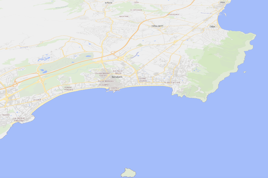
Benidorm is located on the Costa Blanca (Alicante). That much is clear. Our neighbors within a radius of 10/15 minutes are Altea, Alfaz del Pi with El Albir, Villajoyosa, Finestrat, La Nucia and Polop. A little further we find Guadalest or Callosa d’En Sarrià, with the Fuentes del Algar (30 min. approx.).
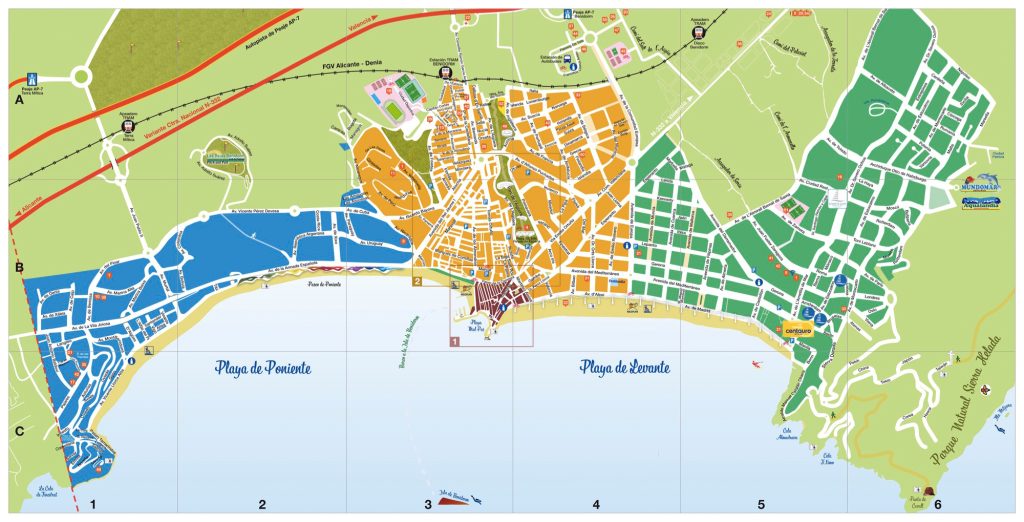
As we can see, we have three main areas in Benidorm, from left to right: Poniente, Centro and Levante. In front of the center, we find the island of Benidorm. In the outdoor areas we find the theme parks and the natural park of Sierra Helada.
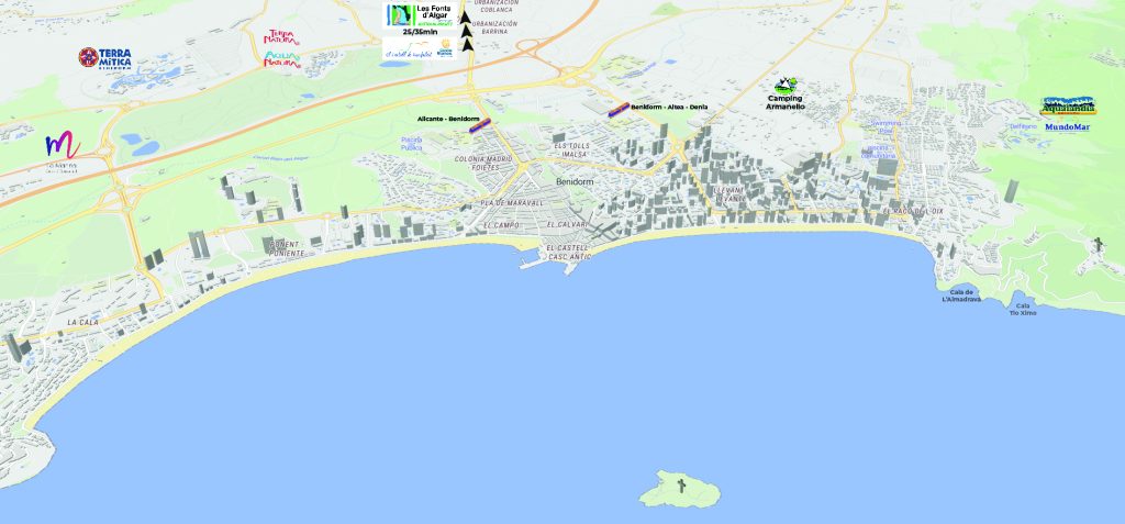
Where is Benidorm located in La Marina Baixa?
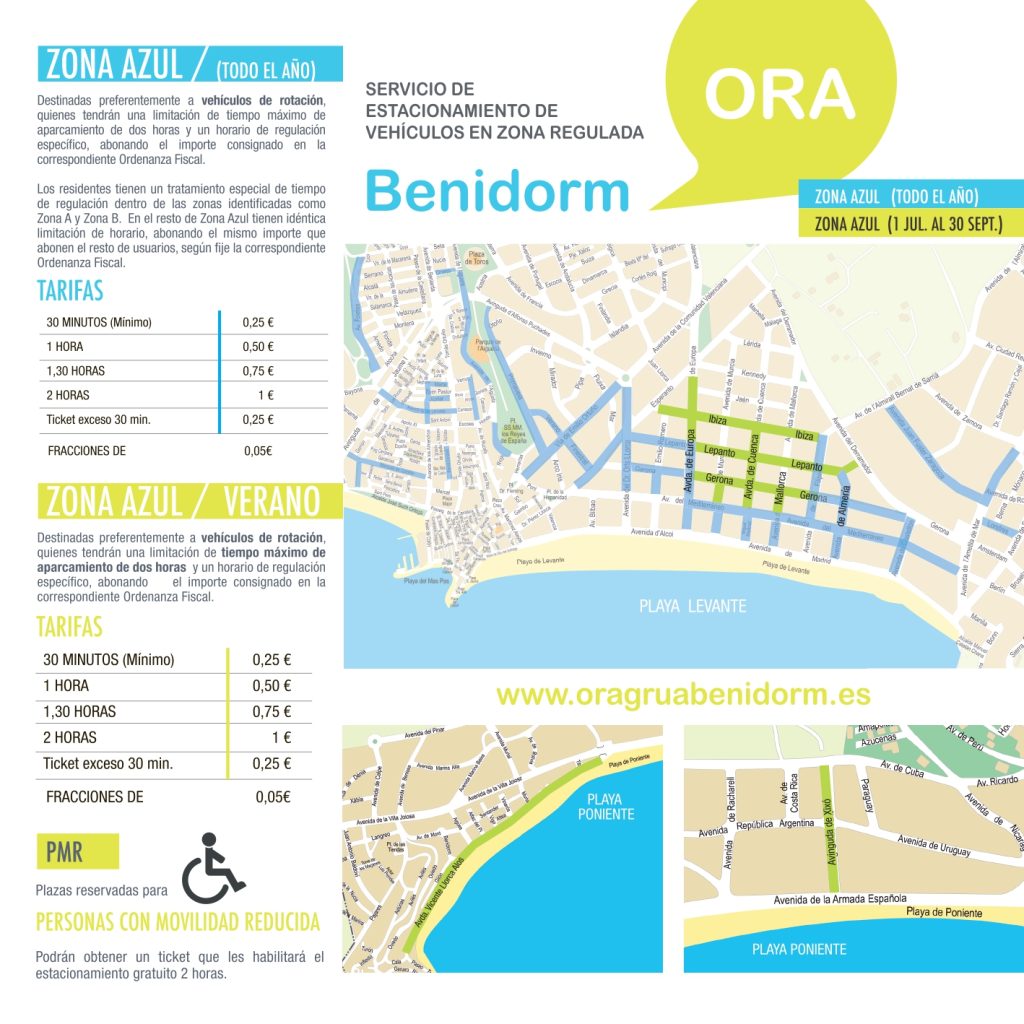
Benidorm blue zone map
Although we have already told you in another post how to park in Benidorm easily and for free, we leave you the map so you can see the streets that are blue zone pay.
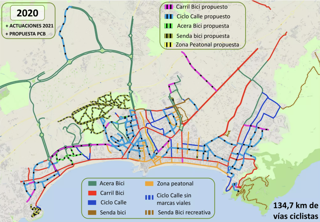
Benidorm Bike Lane Map
Although you can find more information on the website of the Benidorm City Council, we leave you this map of the bike lane so you can see that you can go almost anywhere in the city by bike.
